River Navigation (Inland Transit Day 2)
Illinois River at Senachwine Creek
Chillicothe, IL
Log Entry by Program Manager Tatiana Dalton
Wednesday, October 26, 2022
19:46
It’s a beautiful night on the Illinois River—warmer than it was earlier today, with the silhouettes of trees decorating the edges of the sky to port and starboard. I just wrapped up dinner cleanup in the galley with Brianna, Maddy, and Rob and relocated back to the pilot house, which has become my unofficial office. It’s already hard to remember how long we’ve been going. It feels like it’s been ten days since we got underway from Chicago, not two—so much has happened.
I’m still not used to pulling out my phone, day and night, to watch my little blue dot float down the Google maps river—to me, a tall ship transit usually means an opportunity to put my phone away and let the charts keep the score. But since we’re inland and not offshore, we’re getting consistent cell service. While I appreciate opportunities to unplug, it’s a blessing to stay connected this time because it means I can keep in touch with all of you.
A river transit means different navigational tools than we’re used to at World Ocean School. The first thing we teach our students is how to use a nautical chart. Most of the students who sail with us learn to take a three-bearing fix with a hand-bearing compass, and some even dive into celestial navigation by calculating Local Apparent Noon with a sextant.
But we won’t touch a single nautical chart until we depart Mobile for the Gulf of Mexico. There are no nautical miles in river navigation—just statute (land) miles. So, no nautical charts—what do we use instead?
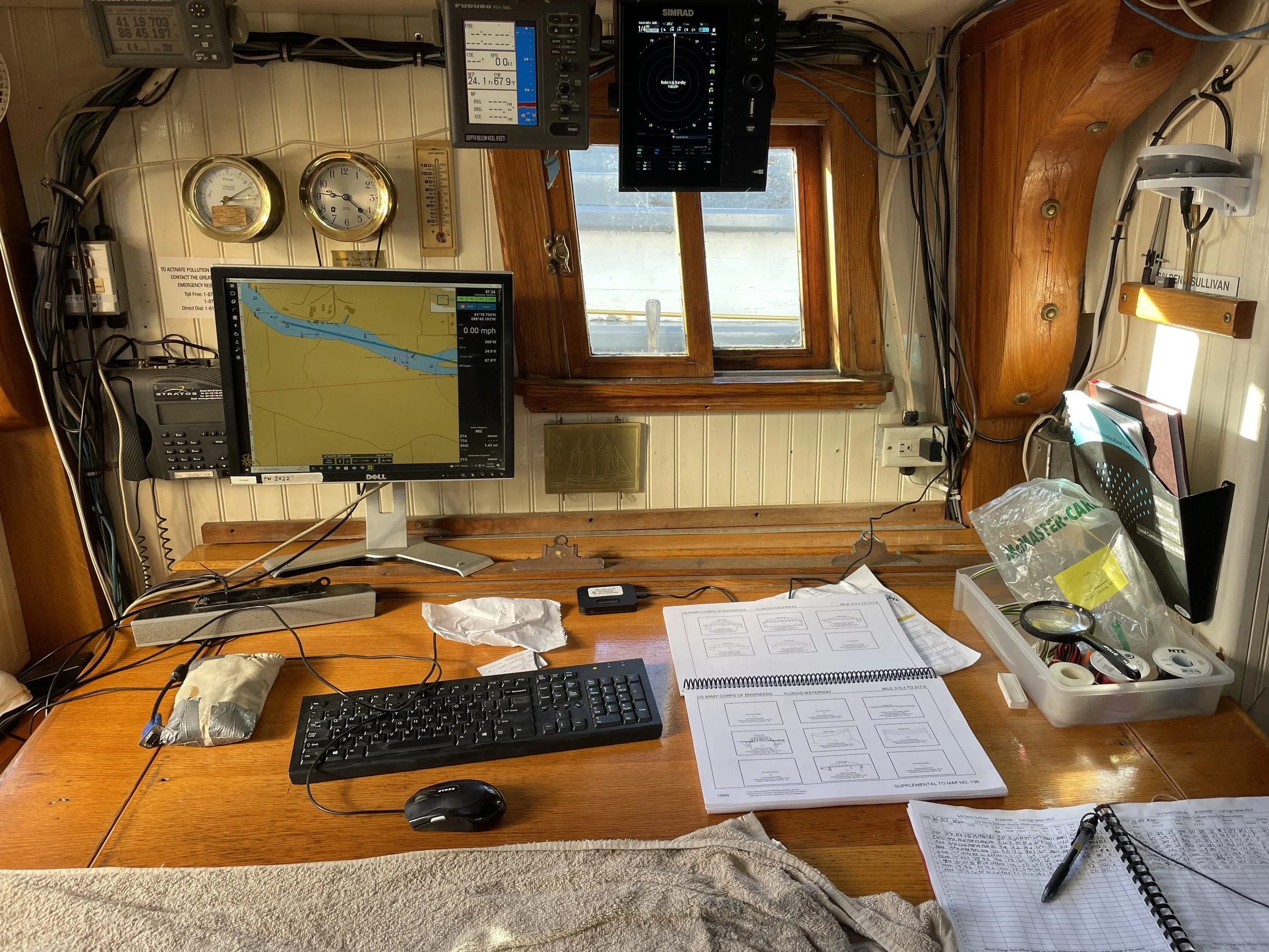
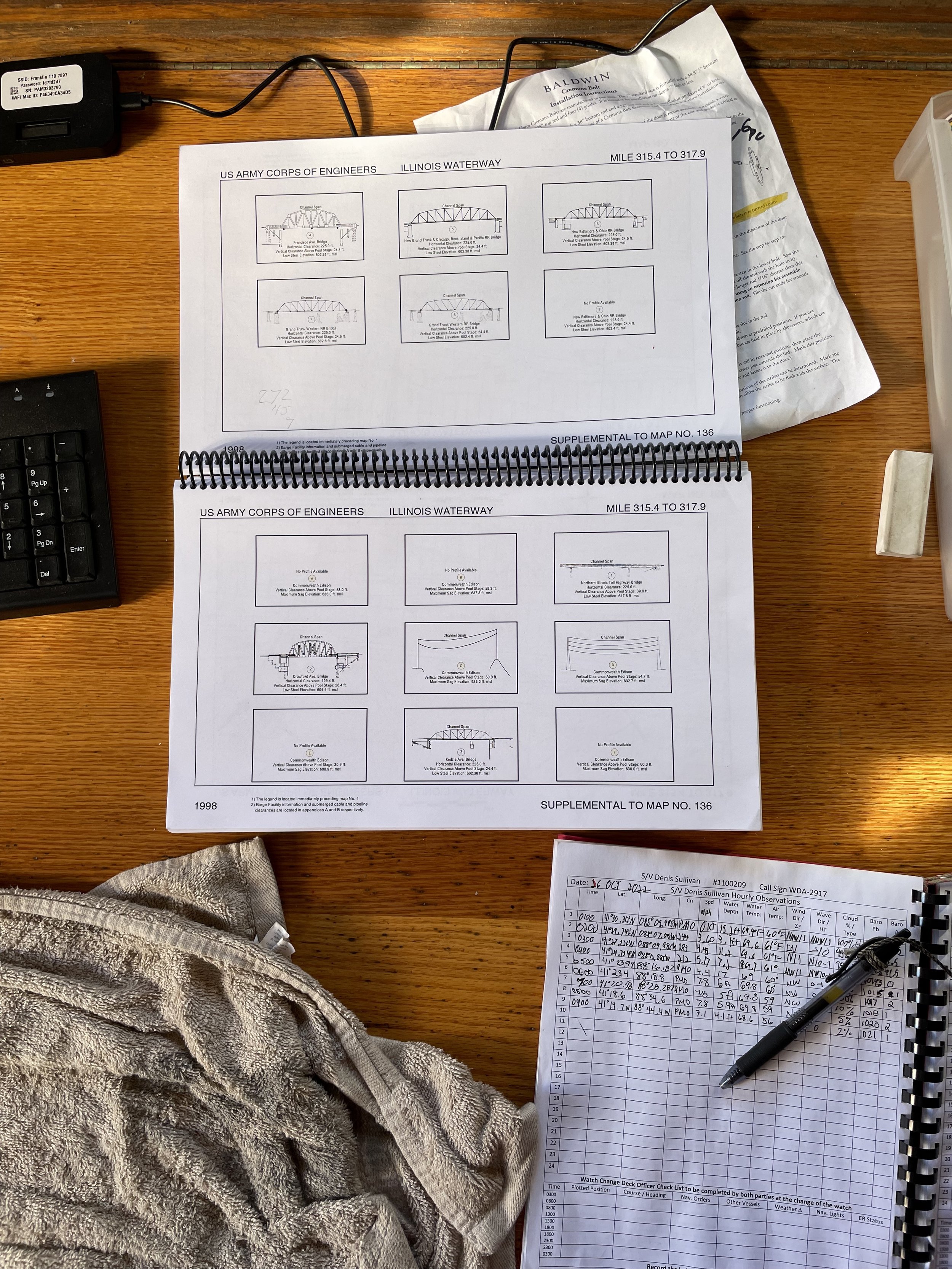
Here’s a hint—there are still plenty of paper pages to worry about when the cabin top starts leaking! On this transit, those pages belong to the Great Loop Inland Rivers Chartbook. This book contains charts produced by the Army Corps of Engineers to guide us along our portion of the Great Loop—a route that circumnavigates the eastern United States. Each page shows a small portion of river, marked with bridges, locks, and other land features. The charts note the height of each bridge and set of electrical wires—anything that could get a boat stuck from above—from the water.
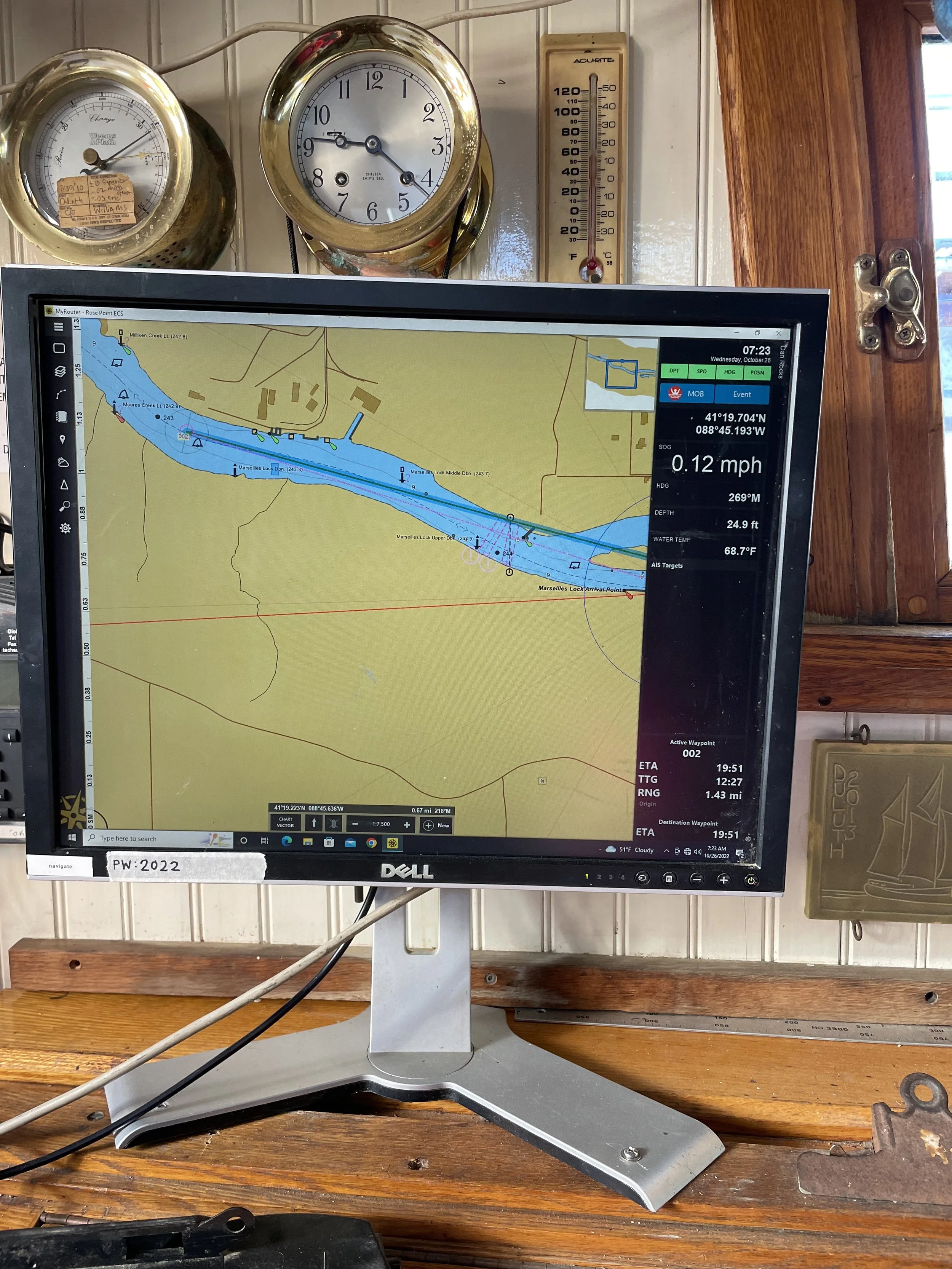
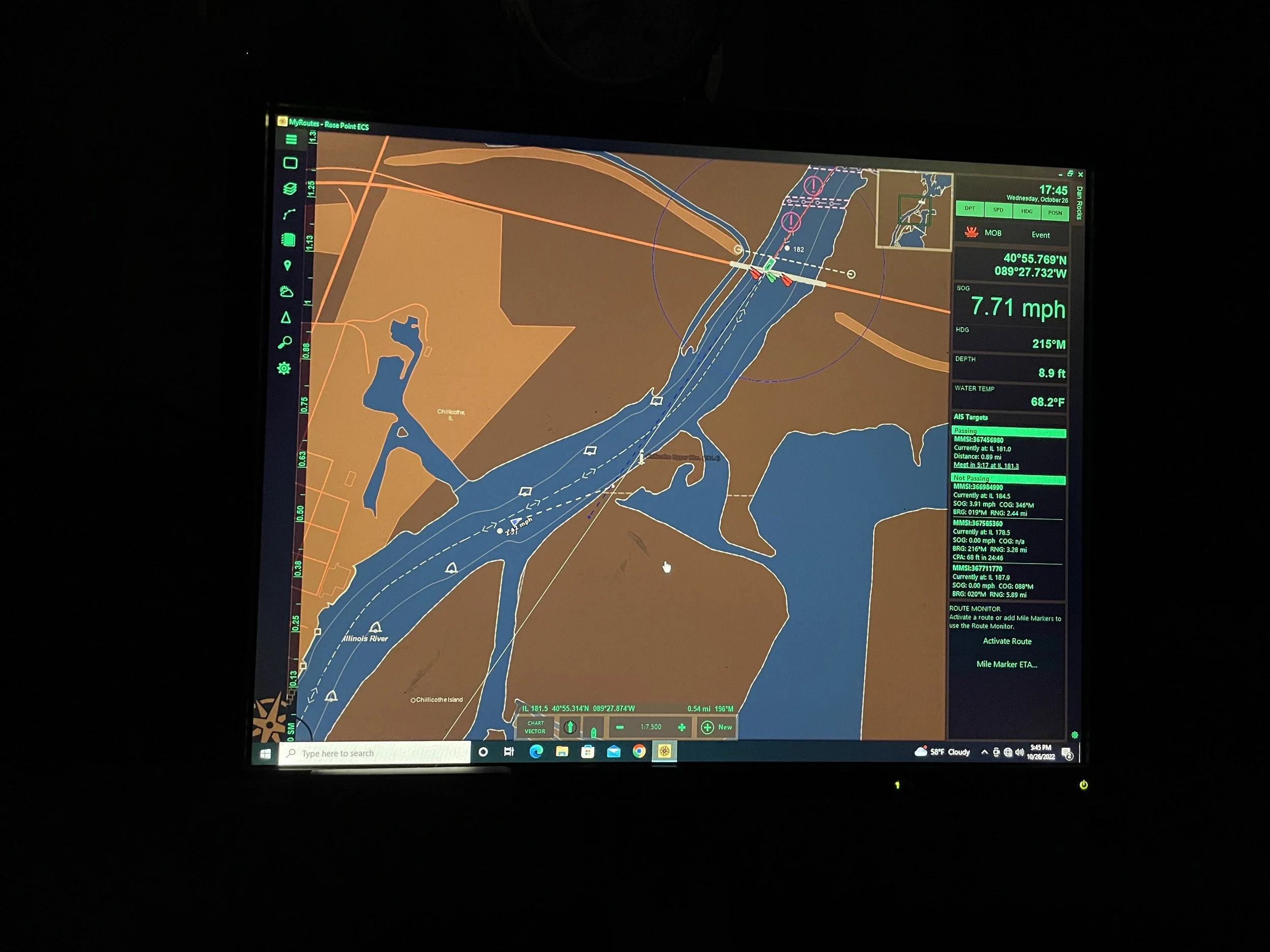
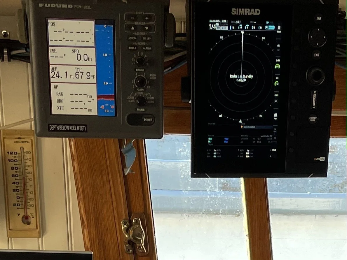
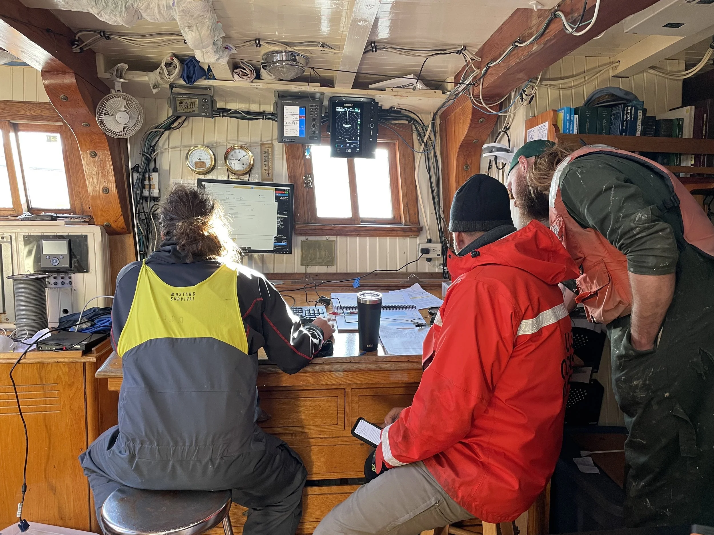
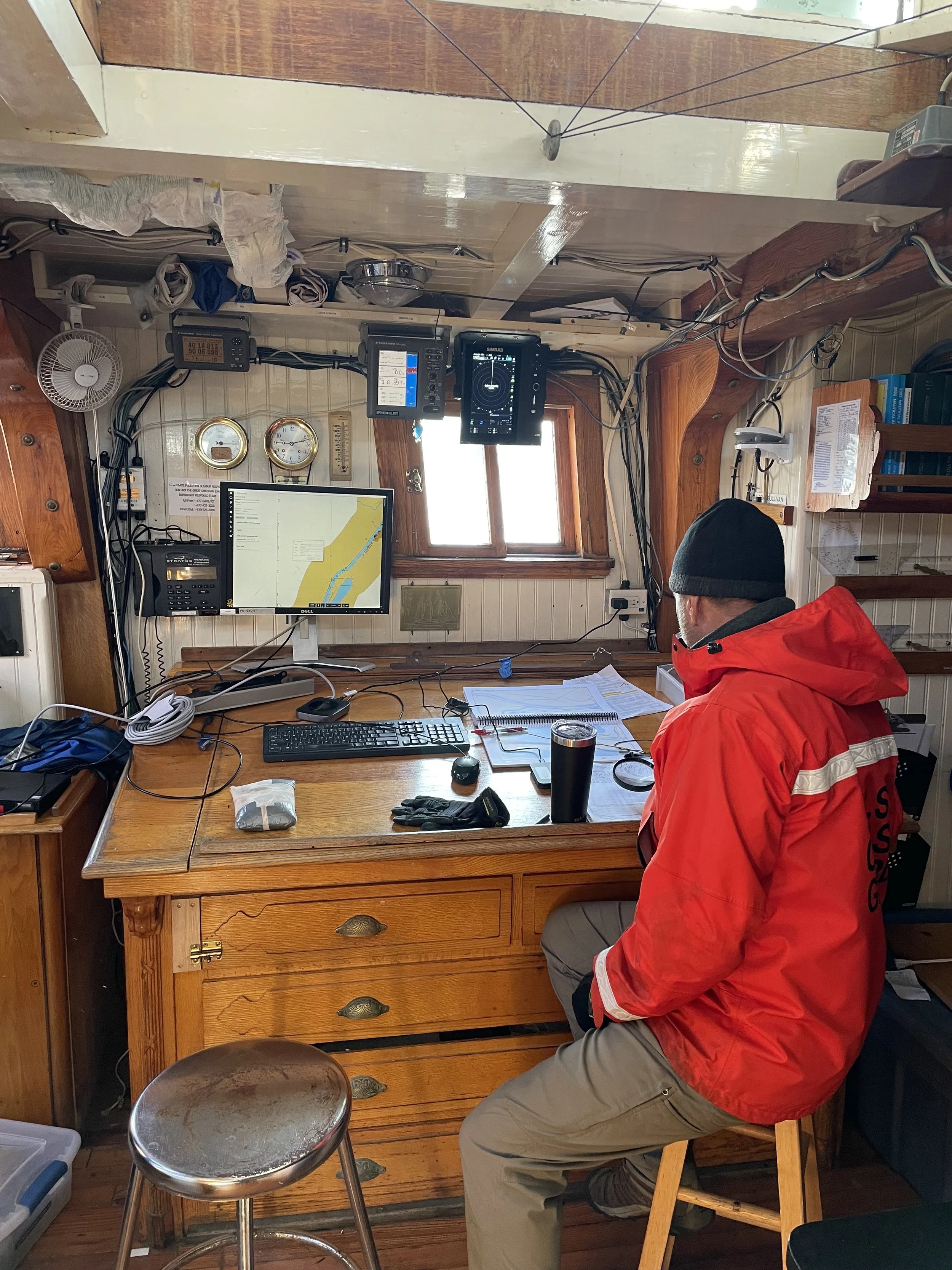
The Denis Sullivan has also been outfitted with a new electronic navigational system to complement these paper charts. Rose Point ECS is a navigation software that provides more detailed information and is updated more quickly than most other navigation programs, and it connects to a wireless internet signal rather than GPS.
But wait—there’s more. Denis Sullivan is also equipped with a radar system (to detect obstacles around the boat) and a depth sounder (to report the depth of the water at our current location)—plus a variety of other tools to provide additional assistance.
Our most important task as mariners is to care for our ship, our shipmates, and ourselves. Skillful navigation keeps us all afloat and out of harm’s way–all the way to Mobile, St. Croix, and beyond!